By Srisharan Shreedharan
Subduction zones are regions on the earth’s crust where a tectonic plate (usually the oceanic plate) ‘subducts’ or shears under another plate (usually the continental plate). Subduction zone earthquakes, which happen in many locations globally, can be incredibly devastating depending on their size and potential to cause large tsunamis. This is more so since many of the world’s population centers, such as San Francisco, Tokyo, and many cities in New Zealand, are situated close to subduction zones.
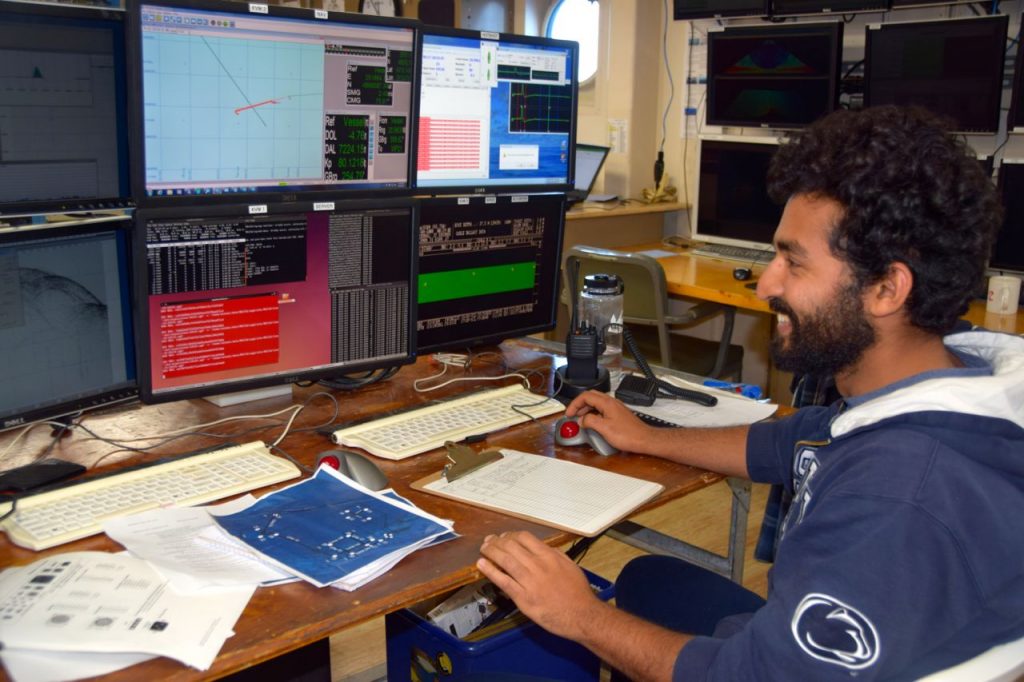
As a graduate student interested in the evolution of subduction ‘megathrusts’ or large subduction zone earthquakes, I study them by conducting small-scale rock friction experiments. I am looking at how friction is different in various locations along the subduction zone and what this means for future earthquakes in these regions.

Earthquakes occur on faults, which are simply the interface between the two plates, in the context of subduction zones. Faults, with their not-so-smooth surfaces, thick sediment layers, and fracture zones display a variety of frictional behaviors. Frictionally, faults can be velocity strengthening or weakening. This means that with an increase in fault slip speed (like during an earthquake), the friction of velocity strengthening faults increases. This prevents an earthquake from further propagating because there is now an increased resistance to sliding on the fault. On the opposite end, velocity weakening faults have reduced friction values as their speed increases, and they further promote earthquake rupture, which can grow into very large hazards. If these quakes occur on oceanic faults, the earthquake can even reach the seafloor and create large tsunamis like during the 2011 Tohoku earthquake and the 2004 Sumatra earthquake.
Equipped with this knowledge, I conduct experiments in my lab where I shear, or slide, two small pieces of rock against each other and change their relative velocities to observe how they behave frictionally. I conduct my experiments in a large hydraulic press, which is essentially two hydraulic rams providing a force along the rock-rock interface and perpendicular to it. Sometimes, this results in the creation of stick-slip instabilities, which are really cool small-scale manifestation of earthquakes (or labquakes!).
There is evidence (based on the type of experiments I described earlier) that smectite, a type of clay, exhibits velocity weakening behavior over the pressure – temperature regimes necessary to propagate earthquake rupture near the seafloor close to the subduction zone. Scientists have studied subduction zones around the world for many decades now, and they have recently discovered that not all subduction zone earthquakes reach the seafloor. Based on these two observations, my work here at the Cascadia Margin is to image beneath the seafloor at different locations along the margin. I am looking for changes in fault structure over time. To do this, I plan to re-survey a region, which was last surveyed over two decades ago. Fault displacement/shift, if any, will give me more insight into how close to the seafloor the earthquakes from the past 20 years may have propagated. My survey line also goes over a scientific site that was last visited over 40 years ago.
I will combine the new seismic data from this survey with the existing data to accurately describe the many layers of rock and sediment that will invariably show up in my sub-sea floor images. I plan on using these datasets as a baseline to comment on the presence/absence of sediment layers (eg. smectite) in other seismic images acquired during the cruise. This will help me make an informed judgement about the potential for large tsunamis at various locations along the west coast.
In many ways, laboratory and field studies go hand in hand, especially in the context of earthquakes. Not all kinds of data can be collected in the field due to time constraints, instruments sometimes break down and there are field constraints such as bad weather. Experiments conducted on a much smaller scale provide us with the flexibility of exploring a larger set of parameters to explore. This helps build an intuitive understanding of how larger scale hazards like earthquakes and tsunamis work in nature. It also helps us build testable hypotheses and theories that we can back up — or refute — based on field scale observations. Ultimately, these experiments and studies help us, as a population, build better early-warning instruments, create more robust building codes in extremely earthquake-prone areas, and create tsunami resistant structures in coastal areas.
— Srisharan Shreedharan is a Ph.D. student at Penn State University
