By Irina Filina
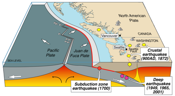
A large destructive earthquake in the Cascadia Subduction Zone is long overdue. The earthquake, often referred as a megathrust, is expected to produce a tsunami that will affect the western coast of the U.S. and Canada. With this in mind, the region’s coastal population is training to get ready for this event and scientists are working to better understand what it may be like.
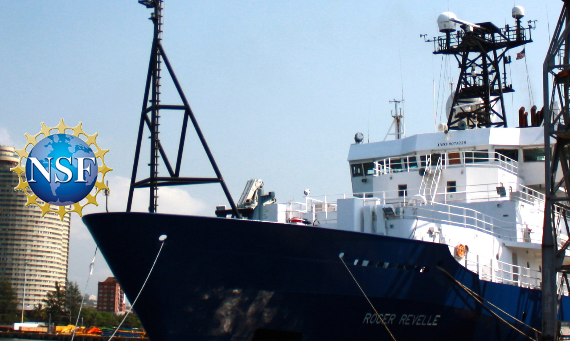
In Newport, Oregon, just before boarding the R/V Roger Revelle for this scientific expedition, we had to participate in a mandatory tsunami drill. We walked together to the highest elevation in the port area, which is a designated point for people to gather in case an earthquake and tsunami happen. The necessary supplies of food and water are stored at this muster point, allowing the people affected by tsunami to wait while the water level drops off. Posters with directions and estimated walking times to the muster point are established on the way to the location. These posters serve as mitigation to the expected hazard; they definitely will be crucial for the people affected when this expected earthquake hits the northwest coast of the U.S., and may save many lives.

The megathrust in the Cascadia Subduction Zone is associated with the area where the young, oceanic Juan de Fuca plate is sliding under the continental part of the North American plate. In order to assess the hazards, mitigate the damage, and make improved predictions about this potentially devastating event, it’s necessary for scientists to have a reliable and detailed geologic model of the Earth’s lithosphere – the uppermost rigid layer of the planet. This subsurface model consists of information about the thickness and lithological composition of the rocks of both plates, usually organized in layers, such as sedimentary strata, various crustal units, and the upper mantle.
In order to develop a geologic subsurface model, a variety of remote sensing geophysical techniques are used, such as seismic sounding and potential fields (gravity and magnetic) surveying. All of these techniques share the same underlying principle – they use the measurements of some physical phenomena at the Earth’s surface to derive geological information about the rocks in the subsurface. Different methods focus on different physical phenomena – acceleration due to gravitational force is measured for gravity prospecting, the strength and direction of the Earth’s magnetic field are recorded in magnetic surveying, while the ground motion (onshore) or water pressure (offshore) is measured for seismic sounding.
Seismic reflection sounding is the most widely used geophysical method scientists use to map the variations in thickness and lithology of the subsurface layers. This method uses artificially created sound waves that spread through the rocks in the subsurface and are reflected and or refracted at each contact between the different rock layers. The resultant complex pattern of reflected and refracted seismic waves is recorded at some distance from the source of seismic wave.
Interpreting these various seismic arrivals can be challenging and they don’t always provide an interpretation scientists are confident in. In this case, the other geophysical measurements, which record information about the same subsurface, may be integrated with seismic sounding data to constrain the resultant geological model. One of these complementary geophysical techniques is gravity surveying, which is sensitive to variations in the densities between various rock layers in the subsurface. Another technique is magnetic field analysis, which maps the changes in rocks’ magnetic mineral content, described by a physical property named magnetic susceptibility.
A focus of my scientific research is combining records from various geophysical methods together in order to derive a reliable subsurface model that honors all the recorded datasets. During this expedition, the data for all three geophysical methods – seismic sounding, gravity and magnetic readings – are being recorded simultaneously. The integrated analysis of all three datasets together results in a more detailed geological model: the seismic sounding provides the depths to various subsurface layers, while the potential fields allow constraining the lithologies of different geological units (rock layers) based on the derived physical properties, such as densities and magnetic susceptibilities. As the derived geological model should agree with all three datasets, the overall confidence in the result will increase greatly.
The geological model of the Cascadia Subduction Zone that’s created using the data collected during this expedition will improve our understanding of the structures and overall structural architecture of the lithospheric plates involved in the anticipated megathrust. Using this integrated geophysical approach that combines three different methods will result in much more robust and confident subsurface models. These, in turn, will lead to more confident and reliable earthquake prediction and hazard assessments that will help keep citizens of this region safe.
— Irina Filina is an assistant professor at the University of Nebraska-Lincoln